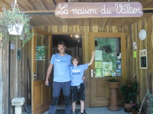
Pyrenees and hiking for groups
General
All hikes are done with a guide, unless mentioned otherwise.
Always check the weather forecast. Some of the hikes can not be done with fog.
All the hikes suggested, are previously hiked by the Bergtoppers, to exclude any surprises!
Hike to the paradise
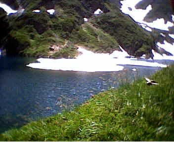
Hike from the Col de la Core (1395 meters) to Etang d’Ayes (1860 meters) and back to the Col de la Core
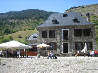
 This hike starts at the Bergtoppers. From here we go up to the col de la Core that we reach in an hour.
From the Col we walk to the Cabin of Clot d’Eliet. After ½ hour we can see lots of framboses and maybe we shall see some Isards. The first part of the climb is a heavy one.
From the cabin it is another 30 minutes to Etang dÁyes. This is a lake where we shall have our lunch and you could take a swim if you want.
After our lunch we walk back to the Col de la Core. This col is often done in de Tour de France
Remarks
Bring your packed meal.
Start and finish at Bergtoppers.
Approximately 6 hours hike, 700 meters difference in altitude.
Suitable for everyone.

Circular tour at the Cirque the Cagateille
This is the second day of our program.
Today we start with a transfer to the parking of the Cirque the Cagateille in the vallley of Ustou.
From the entrance of the Cagateille we walk to the cirque that we can reach after 30 minutes. From here we go further into the valley and after some nice sceneries we start climbing.
It goes up pretty steep in the woods. Finally we come above the tree line and the last hour is very rocky. After this rocky part we reach the first lake, etang de la hilette, where we shall have our lunch.
After our lunch we can decide what to do, walk back the same way or go to another lake, etang dálet, and pass the magical hight of 2000 meters!
Remarks
Bring your packed meal.
Start and finish at the Cagateille.
Approximately 6-8 hours hike, 1.000 meters difference in altitude.
Hike is suitable for everyone in good shape, not possible to walk in fog.
Hike from the Riberot (900 meters) to Estagnous (2245 meters)
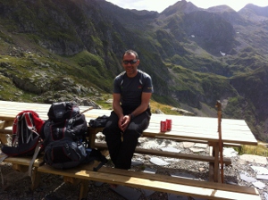 We drive to the Riberot where we start our hike to the warded refuge Estagnous. After an hour and 30 minutes we reach a very nice cascade, a good place for your first brake or our lunch.
From here we climb further a little steeper and now we start sweating.
After an hour climbing, or a little more, we reach un anwarded cabin. A very nice place to take another brake. From here we can also see the refuge Estagnous.
Now it is another hour climbing.
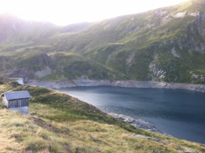
Fortunately we can drink a very big beer or something else and have a hot shower at the refuge………….
There are also some little lakes around the refuge which are called “estagnous”.
Remarks
Bring your packed meal
Start Riberot, end Estagnous
Approximately 4 hours hike, 1.300 meters difference in altitude.
Suitable for everyone in good shape or people that are walking for 2 or more days.
Climbing of the Mont Valier (2838 meters)
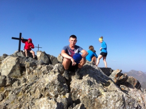 Today we’ll climb the Mont Valier!
From the cabin of Estagnous we’ll climb about 1 ½ hours to reach a saddle. It is another 45 minutes walk to the real top.
As soon as we reach the top we’re at the highest point of the Haut Couserans: 2838 meters!
Remarks
Start and finish at Refuge dÉstagnous.
Approximately 3-4 hours hike, 600 meters difference in altitude.
Suitable for everyone.
Hike from Estagnous (2245 meters) to Montgarri (Spain, 1565 meters)
 After having breakfast, we’ll head for the Spanish refuge Montgarri.
First we descend to the lake Rond and than we ascend to the lake Long. When we climb to the second lake we have some assistence of steal cables.
After that we have reached Etang Long.
This part that we have done from refuge Estagnous just before the lake Etang Long is also a part of the Chemin de Liberte or the Freedom trail. At the refuge you find a monument of this trail.
We walk next to the lake and start climbing to Port the Barlonguera, another 300 meters going up….
If we have reached this port we are just next to the Spanish border, time for a first lunch brake.
After our brake we have to climb another 200 meters, it starts easy…. At the border we can look back to the Mont Valier and refuge Estagnous. We walk further into Spain via a very beautiful area. After a gentle walk we go down very steap on the grass. After this descend we go down for another 600 meters but that is easy. Finally we reach the Spanish refuge Montgarri a former monistory……
Will they have bear or wine?
Remarks
Bring your packed meal.
Start at Estagnous and finish at Montgarri.
Approximately 7 hours hike, 1000 meters difference in altitude.
Suitable for everyone in good shape.
Only possible with good weather conditions.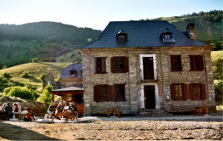
Hike from Montgarri (Spain, 1565 meters) to Salau (850 meters)
Today we leave Spain and go back to France after a very good Spanish breakfast.
We start with an easy walk of two hours next to the river Noguera Pallaresa, through a wooded area. We walk into the valley d’Aran. After the valley we start with an easy climb to Port Salau.
After 2 hours we can reach Port Salau where we shall have our lunch here, at the border of Spain and France. We see the remains of the trade of wood, done between the French and Spanish in earlier days.
After having lunch we descend to Salau, to finish at a terrace in Salau.
We end the hike here while waiting for our transfer.
Remarks
Bring your packed meal.
Start at Montgarri and finish in Salau.
Approximately 8 hours hike, 1.100 meters difference in altitude.
Suitable for everyone.
Hike from the Col de la Core to the river of the Riberot
From the Col de la Core we’ll head for the Col d’Auedole via a nice, rough path. We’ll probably see lots of raspberries and isards.
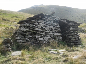
After a 1 ½ hours walk we’ll reach a cabin, a shelter for maximum 5 people.
We’ll continue to climb for ½ an hour to a lake with a beautiful view: Etang d’Ayes.
A beautiful place to have a break. We can even have a swim at the lake… After another hours walk, we’ll reach another cabin. Here we’ll find a sign for the valley of the Riberot. We’ll start to descend to the river Riberot, our finish.
A beautiful spot to sit at the river and view Mont Valier.
Remarks
Bring your packed meal.
Start at the Col de la Core and finish at the Riberot.
Approximately 7 hours hike, 900 meters difference in altitude.
Suitable for everyone.
From the Riberot to the Eylie
 Today is our second day of this 6-days hike.
After our well prepared french breakfast we start earlie because we have to climb twice a mountain.
We start the first 900 meter climb in the forest and it starts very steap. After a while we reach the trea-line and we have some nice views. We see some cabins and find some water. After 3 hours we reach a cabin at the top which is at 1821 meters.
From this point we go down to the valley of Pucelle (1000 meters)that we can reach in 2 hours. Here we have our lunch brake next to a little stream.
After our brake we have to climb another 800 meters. Maybe not so steap as in the morning but still going up. We meet also another track, the Tour du Biros. Not so long as the GR10 (50 days) but also interesting to do in this area.
Finally we reach col de LÁrech at 1802 meters. From here you can see the mountains that we climbed yesterday and you can also see all the mountains that have to be done for the next days. For example you can see the Mont Valier (2838) and the Pic de Crabere (2629).
Now we only have to go done for 900 meters…..
Finally we reach the gite Eylie, a traditional gite détape where the prepare a very delicous dinner.
Remarks
Bring your packed meal
Start Riberot, end gite Eylie
Approximately 7 hours hike, 900 meters difference in altitude
Suitable for everyone.
From the gite Eylie (920 meters) to the Refuge d’Araing (1965 meters)
 This day is our third day of this 6-days hike.
After a traditional French breakfast we start our hike that will take about 4 hours so we don’t have to get op very early.
From the gite we go on via the GR10 that starts very steap. Soon it will become less steap and we meet some rests of mining.
As soon as we are above the tree line we see station rouge.
We keep going on and come to a path which is horizontal, nice to walk for a change. The end of this path leads us to the Mine the Bentaillou.
From here it is another 300 meters going up to Serre dÁraing (2221 meters).
Now we can see (refuge) Etang dÁraing and also the pic de Crabere. The refuge can be reached in less than an hour.
If we are early at the refuge we can also do the Pic de Crabere (2629 metes) without your backpack!
Remarks
Bring your lunch
Start gite Eylie and finish at the refuge d’araing.
About 4-6 hours hike, 1300 meters difference in altitude.
Suitable for everyone in a good shape.
Vanaf Refuge d’Araing (1965 meter) naar de refuge de Montgarri (1650 meter)
 Today is the fourth day of our 6-days hike and I think one of the most beautifil days! It is also a long day whith just a few water points so we have to take a lot of water.
After an early and very traditional French breakfast we start our hike and walk back to Serre dÁraing. From here we walk towards the Spanish border. The track is very rocky but also very beautiful. Just before the Spanish border we reach a little lake where you could swim. After the lake you have a nice picture of the Spanish side.
Down we see the Spanish lake Estany Long de Liat.
We stay high and follow the path that is signed with yellow markers. You will notice that there is a difference between French and Spanish paths. We also walk a part of HRP so this is really mountain hiking!
After a few hours we reach Lac de Montoliou, a very good place for a longer brake and also possible to take a swim. From this lake it is another 3 hours hiking to the Spanish refuge Montgarri.
We have to do just 1 col and from there we start going down. After 2 hours going down we shall reach the Spanish refuge Montgarri. Here we can take a free hot shower and have a very good dinner…..
Remarks
Bring a packed meal
Start refuge d’araing end refugio montgarri
About 8 hours hike, 1000 meters difference in altitude.
Suitable for everyone in a good shape.
From Montgarri (1650 meter) to refuge Estagnous (2245 meter)
 Today is the fifth day of our 6-days hike and this is also a very beautifil one.
After the excellent Spanish breakfast we leave Montgarri and we start with a simple climb. We pass a river and go into the trees. If we have done another col we can look back to the Spanish refuge Montgarri, maybe you will see this nice refuge again. Now we are walking to coma Giretta.
Here you can see marmots very often, hopefully you are lucky! Now we have to climb 400 meters on grass.
After this climb we are at Port de Girette which give you a nice view to Spain.
We go on for a gentle walk and reach the French border. Soon we have a beautiful view on the French side and we can see the Mont Valier (2838) and refuge Estagnous. We go down to Port the Barlonguera and further down to Etang Long where we can take a swim and a well earned brake.
After Etang Long we go further down to Etang Rond with the assisatance of some cables. From Etang Rond we have to climb the last 300 meters of this day.
Refuge Estagnous is a beautiful refuge in the mountains where you can take a hot shower or a swim in one of the little lakes (Estagnous). Dinner is good and the alsy provide drinks and little snacks.
Remarks
Bring your packed meal
Start Montgarri end Estagnous
About 6 hours hike, 1000 meters difference in altitude.
Suitable for everyone in a good shape.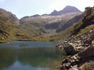
From Estagnous (2245 meter) back to the Col de la Core (1395)
Today is our last day of the 6-days hike and also a beautiful day.
After the traditional French breakfast we start climbing to Col de Pecouch, a 200 meter climb and an easy warm up for us (now after 5 days hiking).
The part of Etang Long to Col the Pecouch is also a part of the Chemin de la Liberte, or Freedom trail. The freedom trail was used by people in the 2nd world war to escape to england.
From col de Pecouch we go down on a rocky plate and finally we come to a beautiful lake where you can take a nice swim. (Etang de Milouge)
We continue the track in the higher mountains and come to Cap de Lauzes. From here the route is known because we have done this on the first day. We come to Etang dÁyes and from here it is not long to the col de la core. Here we find the van but we can also choose to walk this last hour…..
Remarks
Bring your packed meal
Start Estagnous end Col/Bergtoppers
About 7 hours hike, 900-1200 meters difference in altitude.
Suitable for everyone in a good shape.
The leaving day from Bergtoppers