GR10 Description in the Pyrenees
The Ariege from Fos to Merens in 2018
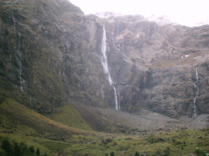
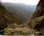
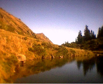
Cirque de Gavarnie
The French Pyrenees are about 900 km and consist of the Pyrenees Atlantic, the Central Pyrenees, the Ariege and the Pyrenees Orientales.
The Atlantic Pyrenees consist of the Pays Basque and the Bearn. The GR10 part here is about 260 kilometers and starts in Hendaye and ends in Arrens.
The GR10 part what goes through the Pyrenees Centrales (Hautes Pyrenees and Haut Garonne) starts in Arrens and ends in Fos. This part is about 220 kilometers.
The Ariege consists of the Bergtoppers domain and the GR10 starts in Fos and ends in Merens Les Vals. This part is about 225 kilometers.
The last part, the Pyrenees Orientales, ends towards the Mediterranean and that GR10 part is about 210 kilometers. You start in Merens les Vals and you end in Banyuls sur Mer.
Since 2007 we offer the whole year backup from Melles until Goulier. You must think of luggage transport combined with the reservation of your accommodations. We also offer the whole year (from june till october) 2 self lead GR10 stretches: from Melles to Seix and from Seix to Goulier.
We also offer luggage transport, reservation of your accommodation, deliver maps and a detailed description and we can take care for your lunches.
And we walk the part from Luchon to Merens every year to check if something changed (cabins open/closed, difficulties etc.)
From here a description of the GR10 stretches that I have done. I started at Hendaye and ended in Arrens. Of course any one can use the description but you can also contact Bergtoppers.
Ariege: From Melles to Merens les Vals
From Melles (729 meters) to the refuge of Etang d’Araing (1950 meters)
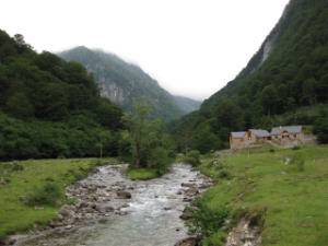
Melles
I started at the auberge in Melles. From the auberge you walk via a paved path through this cozy village, winding your way up. After about an hour you’ll leave the paved road and you’ll pass a Gite de France.
You’ll walk via an unpaved road and the mounting is getting steeper. Via a path through a forest you’ll pass a cabin where you can rest. The GR10 is very well marked and you’ll have to pass ‘water’ several times with the help of some improvised ‘bridges’.
After a couple of hours ascending you’ll reach Col de’Aueran (2170 meters), the highest you’ll get this day. From here it is another hours walk to the refuge of l’Etang d’Araing.
The refuge is situated at a lake. You can eat, drink and sleep at the refuge.
From Refuge de l’Etang d’Araing (1950 meters) to the Gite Eylie (990 meters)
From the refuge you’ll first descend to the lake and you’ll walk around it. At the other side of the lake you’ll see a big cabin with two floors.
Here you’ll climb to Serre d’Araing (2221 meters). You’ll see lots of ‘leftovers’ of the transportation of wood. Now you’ll start to descend again. You’ll pass the mines, which are not in use anymore. An ideal spot to have lunch. There is even water at this spot. It is just a little bit further to the Gite of Eylie en haut.
You can prepare your own meal or have dinner with the ward.
This is an easy day, more like a resting day!!
From the Gite Eylie (990 meters) to the parking Riberot (925 meters)
At dawn, after an early breakfast, you’ll start this long hiking day.
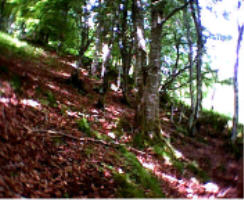
You’ll start right away to mount a steep path to the first ridge. Then you’ll walk through a forest. After a few hours of ascending you’ll reach the Col de l’Arech (1802 meters).
The last bit of mounting is at a field of grass. You’ll follow the GR10 by walking in the direction of a cabin. This is a private cabin and unfortunately is closed. This happens a lot at the GR10: private cabins which are closed.
After the Col you’ll start descending again. Lots of places can be found which supply you with water. After about five hours you’ll reach a river, where you could have lunch. The altitude is about 1010 meters. The first part of today is done.
After having lunch you’ll start again ascending a steep path. Fortunately the path is well marked. After another 2 ½ hours rising you’ll reach the highest point of today: 1821 meters. At the top you’ll find a cabin of a Shepard. Before starting to descend, you can have a little break.
The descending is not too hard and after a couple of hours you’ll reach the valley of the Riberot:
finish of this day.
You’ll only have to put your tent up and prepare dinner.
Or you can spend the night in the auberge la maison du Valier a very comfortable auberge/gite.
A glass of wine and the beautiful scenery will make you forget your tiredness.
The hike from the gite to the Riberot takes about 10 hours.
From the Riberot (925 meters) to the Bergtoppers (1100 meters)
After having breakfast you’ll start your hike again. After a while you’ll leave the valley of the Riberot and you’ll start ascending. You’ll walk to the Cap de Lauses (1892 meters). Along the way there is enough water, it is even possible to take a refreshing dive…
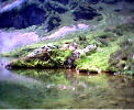
etang dáyes
From the Cap it is another 2 hours walk to Etang d’Ayes (lake of Ayes, 1700 meters). This is a wonderful lake, where you can have lunch and a swim.
After having lunch you’ll descend to the Col de la Core (1395 meters). Again a beautiful place. Along the way there are lots of ‘framboses’ and maybe you’ll be able to see some isards. From the Col it is another hour walking to the Bergtoppers where you can spend the night in our cabin/gite.
From the Bergtoppers (1100 meters) to Seix (500 meters)
Estours
This is a very easy day. You can spend a half day at the Bergtoppers or in Seix. Via the GR10 you go to the gite of Esbints. From there you go further by road to Seix. You can make an extra tour by climbing the Cos hill. Otherwise you can reach Seix in 2 hours. That was the time “The Lazy walker made”.
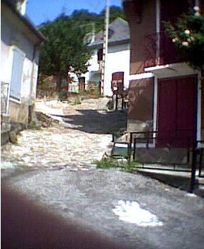
In Seix you find 2 auberges, a restaurant, a baker, 2 butchers, 2 supermarkets, a flower shop, a wine store and you can get money from the wall. In spring it is also interesting for kayakking. So an ideal place for a stop over.
From Seix (500 meters) to Couflens (700 meters)
refuge dáula
From Seix you’ll walk alsong the Salat, stream-upwards, to Moulin Lauga. Here you’ll leave the main road and you’ll continue via an unpaved road alsong the river Estours. You can kayak as well on the Salat as the Estours. As soon as you reach an electricity cabin you’ll get on the real trail again. You’ll continue through a forest. Every now and then you’ll have a glimpse at the wild river Estours. After a few hours walk you’ll reach the Refuge of Aula, where you’ll spend the night in your own tent, on your own mattress and in your sleeping bag. The refuge has no ward and no sanitary provisions. From the Refuge you’ll mount to the Col de Pause. With fine weather you can have a little break.
At the Col you’ll start descending again to the village of Couflens.
From Couflens (700 meters) to the gite in Ustou or Bidous (700 meters)
Now you’ll start ascending again to Col de la serre du Clot (1546 meters). After 30 minutes you reach the gite Rouze. With a nice view to both sides, you can have your lunch here.
After having lunch, you’ll descend to St. Lizier d’Ustou. In St. Lizier d’Ustou you can buy your groceries and have a swim in the local swimming pool. Off-season you can prepare your own meal, or decide to cook with the friendly warden.
From the Gite of Bidous (750 meters) to the Gite of Aulus les Bains (750 meters)
GR10 Bidous – Aulus les Bains
After having breakfast you’ll start (of course) with a little ascending.
You’ll end up at Col d’Escots (1618 meters).
along the way you’ll have a great view at the ski-area of Guzet Neige.
In winter time you can ski or cross country ski here.
You’ll also have a superb view of lake Alet. Amongst others this lake provides the river Alet with water. Especially in the Spring, the river is great to do some kayaking. From the Col you’ll descend to Aulus les Bains, with some nice views of several cascades.
Aulus les Bains is a village with cafes and restaurants. You can also buy your groceries.
The hike from the Gite of Bidous to the Gite of Aulus les Bains takes about 6 hours.
From the Gite of Aulus les Bains (750 meters) to the Gite of Mounicou (1087 meters)
From the gite you’ll start ascending to the refuge of Bassies (1655 meters), where you can have a nice cup of coffee. A beautiful rough hike.
Via Port de Saleix (1794 meters) you could go to Vicdessos. Vicdessos is a town which you can reach easily by car as well. You can get your groceries here. There is a hotel in town and also several restaurants. But, you’ll not head for Vicdessos at Port de Saleix, but you’ll walk to the refuge of Bassies (1087 meters).
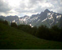
From the refuge you’ll walk at the same height in the direction of Mounicou. Today you’ll have a great view at the Pic de Montcalm (3078 meters): the highest peak of the Ariège. You’ll not mount this peak, but at request at lot can be….
At the end of this long day you’ll reach Mounicou. A small village. You have no opportunities to buy groceries, but you can have dinner at the gite, if you do not want to prepare it yourself.
From the Gite of Mounicou (1087 meters) to the Gite of Goulier (1110 meters)
The highest peak of the day is Barrage de l’Etang d’Izourt (1647 meters). This is a beautiful lake where you can cool down if it is a very warm day.
You’ll reach this lake after about a 6 hours walk. If you start the day early you’ll be able to have your lunch at the lake.
From the Gite of Mounicou you’ll ascend to a refuge (1600 meters). After this refuge you’ll descend again. The silence before the storm: after descending you’ll make the ascend to the lake.
From the lake it is 3 hours descending to Goulier.
Goulier is also a small village without any grocery stores. But there is a nice, cozy Gite where you can drink a nice glass of beer or wine while having dinner.
From Goulier you could walk to Auzat. From Auzat you can take the bus to Tarascon. In Tarascon you can go to Foix, Toulouse and even Barcelone.
From the Gite of Goulier (1110 meters) to Siguer (740 meters)
Siguer
Via an easy climb through a forest, you’ll reach Col de Lercoul (1549 meters). From the Col de Lercoul you’ll descend to Siguer (740 meters).
In Siguer it is also possible to spend the night in a gite. They even provide meals, breakfast and packed meals.
There is a post office and you can take a bus to Tarascon and Vicdessos.
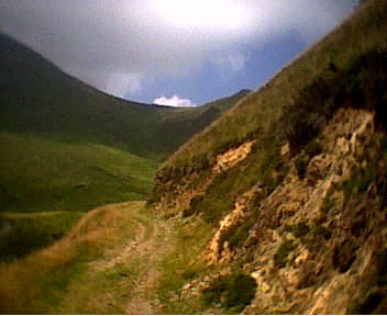
From Siguer (740 meters) to the Col de Sirmont (1693 meters)
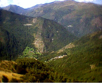
View Siguer
After having breakfast you’ll leave the auberge and start walking up. On your way up you’ll pass a small village: Gesties (950 meters).
After a nice climb through a forest you’ll reach Col de Gamel. From here you’ll head for a nice spot where you have a great view at Siguer (see picture).
From here you’ll start with a heavy climb. At the top you’ll follow the tops of the mountain. It is a nice grassy track.
After a few hours walk you’ll reach the Col du Sasc (1798 meters). Below you’ll see a cabin still in use by some shepards.
From here on you’ll follow the GR10, marked with poles. Not always easy to see, but it is possible. You’ll descend to the refuge of Balledreyt. The refuge is not very well maintained and therefore it is not possible to stay the night. If you walk on, you’ll find some nice spots to put up your tent. If you have some energy left, you could walk to the Col de Sirmont (1693 meters), a heavy climb through the forest. There are enough flat places to put your tent, but there is no water here.
The hike from the auberge in Siguer to the Col de Sirmont takes about 7 hours.
From the Col de Sirmont (1693 meters) to the Plateau de Beille (1939 meters)
restaurant plateau la beille
After having breakfast you’ll pack your bag and with all your luggage you’ll start the hike. Today will be a short hiking day, so you could sleep longer.
You’ll pass a few more spots to camp, with water, but you’ll continue to descend.
After a couple of hours you’ll reach the Cabin of Clarens. You could spend the night here with a few persons, but the cabin has had better days. Near the hut you’ll find water.
You’ll start with a nasty climb over rocks and through a forest.
After a small hour you’ll have ‘vision’ again. At your left you’ll see a lake and also the road, which passed the Cabin of Clarens as well.
After a while you’ll reach the cabin of Artaran (1695 meters). The cabin contains two parts: one part for the Shepard and one for maximum three persons.
From here you’ll follow a cross country circuit and you’ll reach a ski station with a restaurant (1817 meters). Here you can nicely recover from the hike and find yourself a nice spot to put up your tent.
You could have dinner at the restaurant…
The hike from the Col de Sirmont to the Plateau de Beille takes about 5 hours.
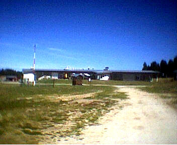
From the Plateau de Beille (1939 meters) to the Refuge du Ruhle (2185 hours)
From the Plateau de Beille it is about a 5 hours walk to the Refuge du Ruhle. The GR10 has been changed, so that the Refuge du Ruhle is now at the track of the GR10.
Today is a beautiful hike, which starts with an easy hike through grass, but at the end of the day you’ll be walking at the top of the world again…
This means walking on hands and feet over rocks. Everybody can do this as long as you do not have fear of heights. Today you can also take your time.
Most likely you’ll see several species of ‘big’ birds.
The refuge where you’ll spend the night is a modern refuge. However it is not possible to make a phone call here.
The hike from the Plateau de Beille to the Refuge du Ruhle takes about 5 hours.

View refuge Ruhle
From the Refuge du Ruhle (2185 meters) to Merens-les-Vals (1050 meters)
After a good night rest, you’ll have a nice breakfast.
Of course you’ll start again with the traditional ascend, but the view is worth the pain. You’ll pass several small lakes on your way.
The highest peak is the Crete de la Lhasse (2439 meters). The scrambling will be done on hands and feet again… After a 3 hours walk you’ll reach the lake shown at the picture. A beautiful place to have lunch.
From here it is easy to descend to Merens-les-Vals.
Merens-les-Vals is the final hike of the GR10 in the department of the Ariège. In Merens-les-Vals is a campsite and a Gite. There is a train station, where you can take the train to Foix, Toulouse or Barcelone.
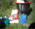
cooking and camping
The hike from the Refuge du Ruhle to Merens-les-Vals takes about 5 hours.